Some seabeds contain large amounts of treasure, including shipwrecks filled with gold or silver. However, the search for this sunken treasure is very difficult, which typically involves sifting through the sand, just hoping to unearth gold or silver.
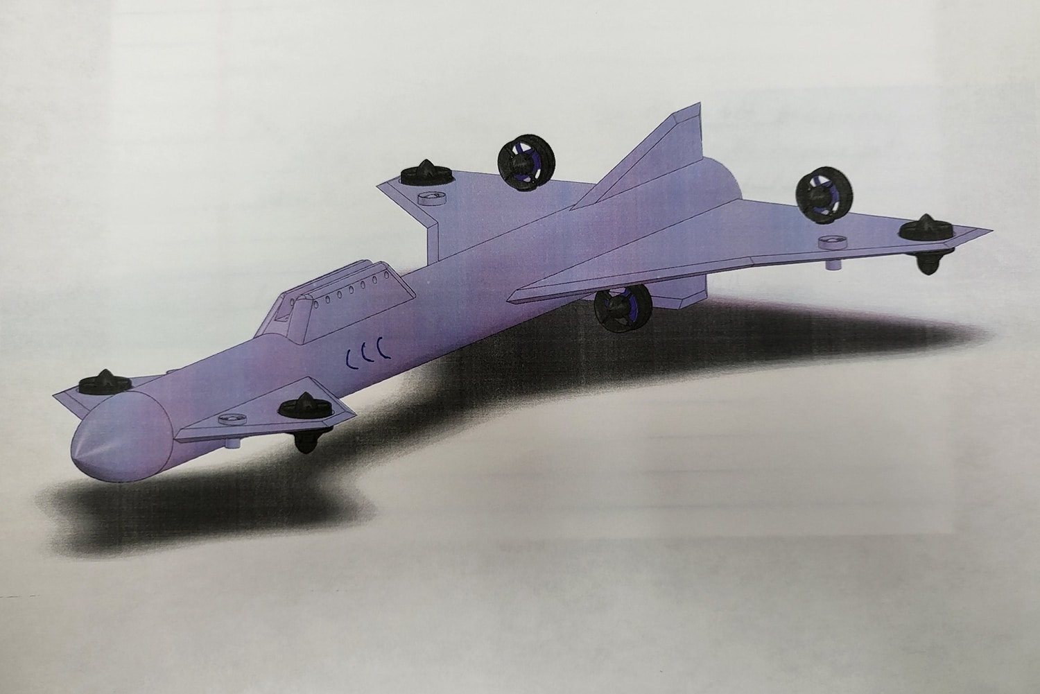
In Florida, the company Seafarer Exploration has developed an underwater drone capable of traversing the seabed to detect – and differentiate – various types of metal buried up to 33 feet (10 meters) beneath the seabed, creating and relaying a 3D digital map of their location.
A Florida-based startup has already begun the construction of the second-generation SeaSearcher platform focused on deeper water and multi-mode exploration. The upgraded design, which has a wider path of metal discrimination and 3D imaging, is more streamlined and rugged.
The SeaSearcher is designed to operate in both autonomous and towfish modes with in-field change out for high current sites. The device integrates sun-bottom imaging, side-scan sonar, precision MEMS differential magnetometer array/direction finder, video recording, and metal discrimination on a single platform.
All sensors will feed back to the SeaSearcher control panel to be displayed or processed by the machine learning algorithms. These changes will allow the second-generation SeaSearcher to cover more ground in a shorter time while continuing to produce results in real-time.
“We have been impressed with the open water tests and live field tests on the Melbourne Beach Area 2 Ring Site, where we have been working under an exploration permit from the Florida Division of Historic Resources (DHR),” said Kyle Kennedy, CEO of Seafarer. “While the SeaSearcher did not see any gold or silver on its initial scan of the Ring Site, it did identify numerous materials including brass, iron, copper, aluminum, lead, and stainless steel.”
He further says the SeaSearcher is based on AI machine learning algorithms; the more it’s used, the more its learning base grows.
“We are now using the SeaSearcher, as weather permits, to scan several other shipwreck sites of interest. We have part of a shipwreck in Melbourne Beach Area 1 that we call the HTQ site. Additionally, we have pieces of what appears to be a shipwreck trail that is potentially from a historic sunken fleet, though a more thorough inspection of diagnostic artifacts must be completed to fully determine its origin. We have located several shipwreck sites that are beyond the nautical three-mile mark, which all need to be scanned by the SeaSearcher. We are excited to scan the Juno Beach Admiralty Arrest site, where previously-conducted survey data was withheld from us by two different entities for the past 14 years. We have found the Juno Beach site has a large and thick teredo crust in the vicinity of the ballast pile that previous salvors assumed was the seabed. Obviously, the crew is anxious to use the SeaSearcher to scan the crust and see what lies beneath it.”
“There are also treasure salvors, both domestic and abroad, who would like to lease the SeaSearcher for use on their shipwreck sites,” Mr. Kennedy added.
This SeaSearcher can find treasures buried under the seabed
Source: Tambay News

0 Comments